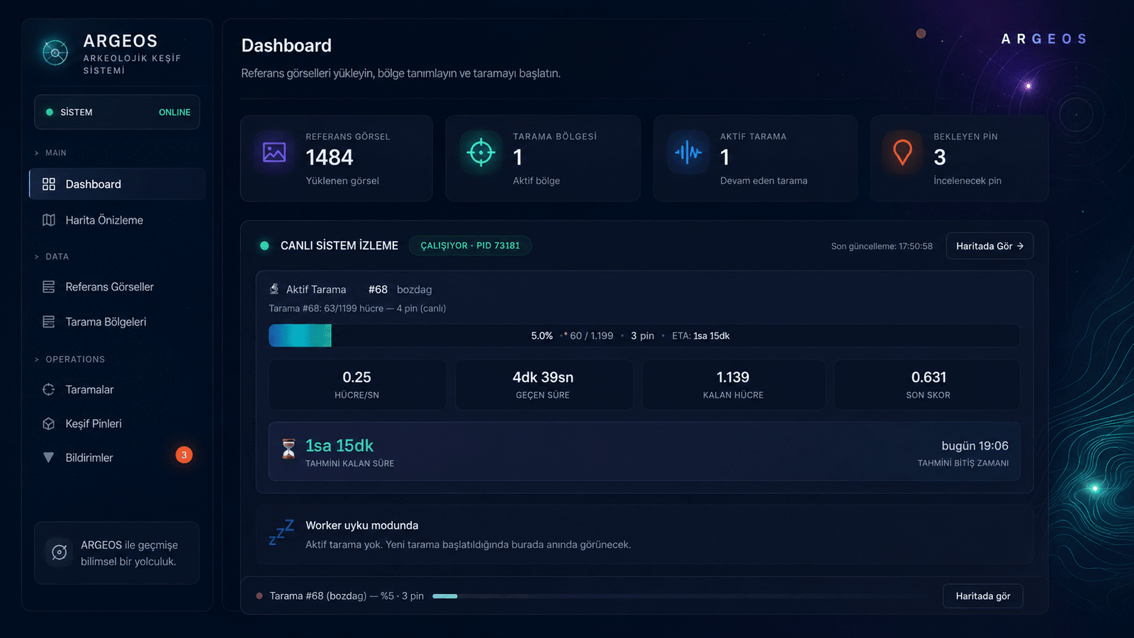
ARGEOS is a command console that compresses field reconnaissance from days into hours. The capabilities below are running in production right now.
Real-time system status, active scans and live metrics.
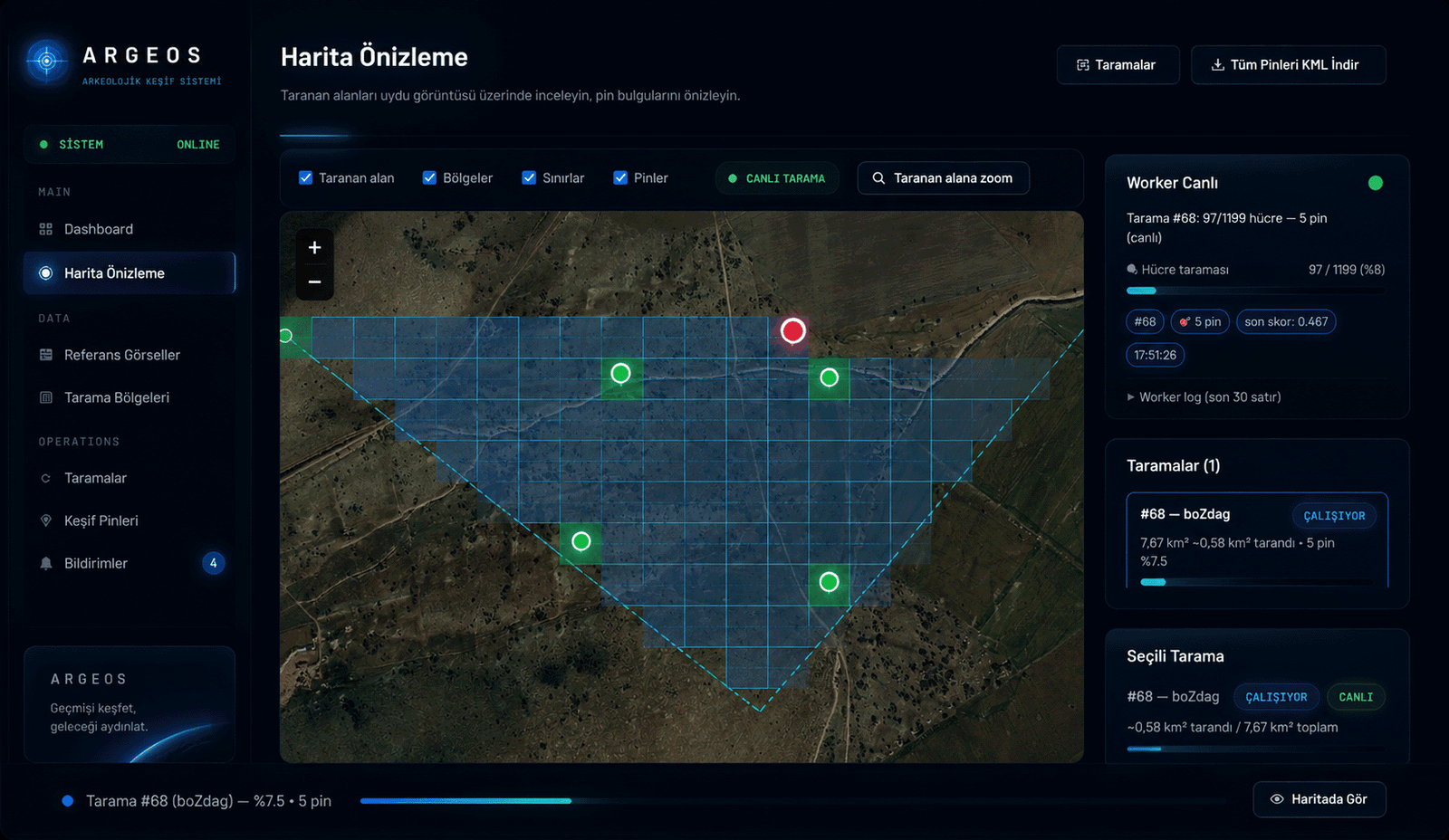
Grid scan over high-resolution satellite imagery.
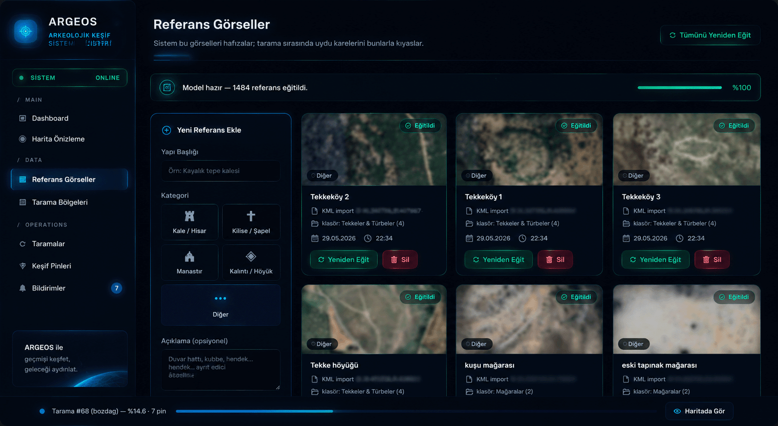
Trained structure catalogs — categorized classification.
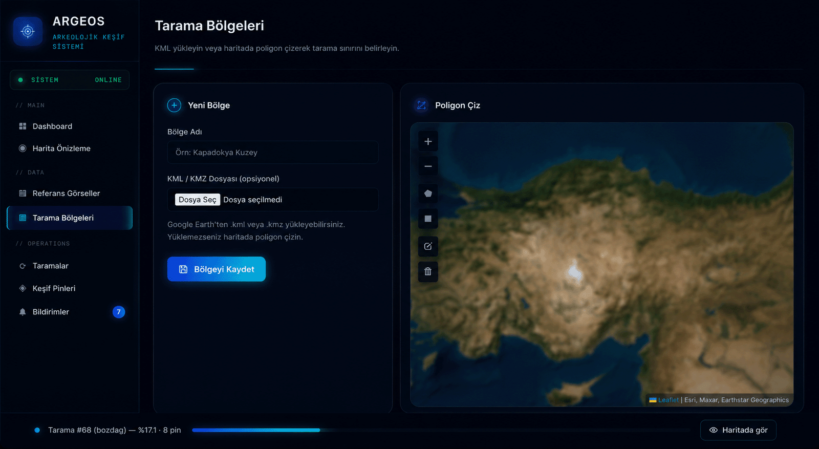
KML upload or polygon drawing on the map.
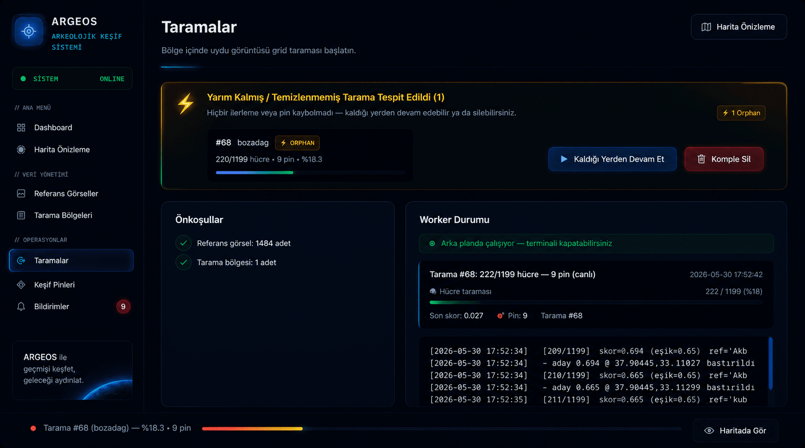
Progress is preserved through any interruption; continue or delete in one click.
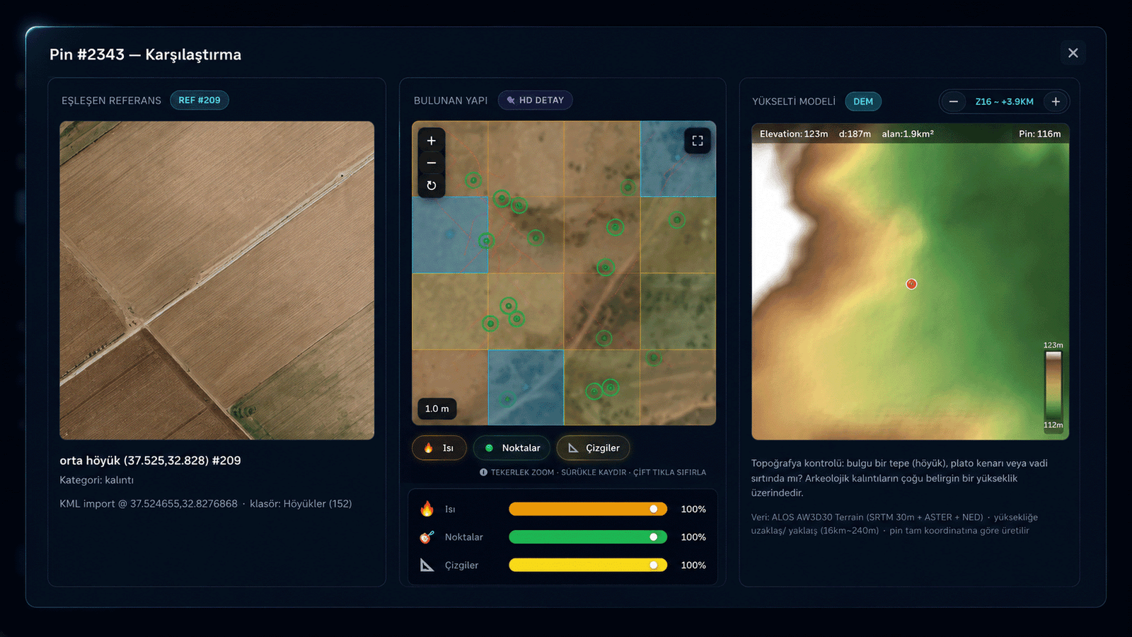
Reference · satellite detail · DEM elevation model, side-by-side.
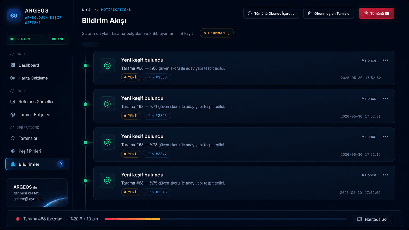
Instant alert for every high-score finding.
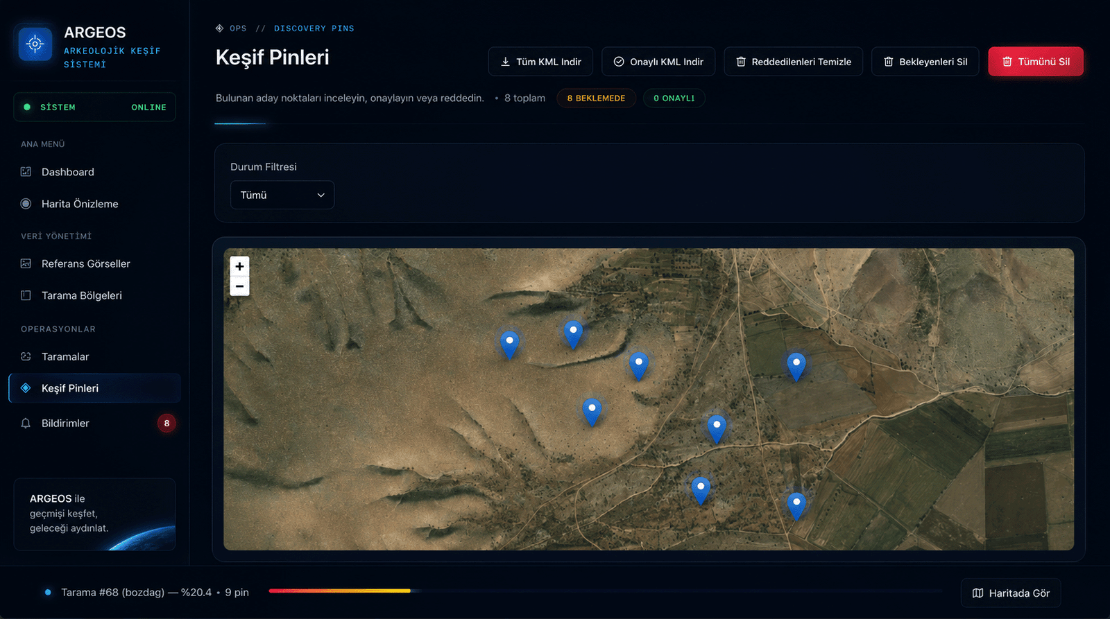
Approval/rejection workflow, filtering and KML export.
The lifecycle is summarized in four steps; behind the scenes, vision-language models, classical computer vision and geospatial analysis work in concert.
Multi-channel feature vectors are extracted from images of known archaeological structures (color, texture, edge, semantic embedding).
The area of interest is defined via KML or polygon; the system slices it into millions of meter-scale cells.
Each cell's high-resolution satellite image is fetched, compared with references, and a confidence score is produced.
Cells above threshold are pinned; experts validate with satellite imagery, DEM elevation model and matched reference.
We evaluate collaboration requests from universities, museums, excavation teams and national institutions. Apply for early access.
Application Form