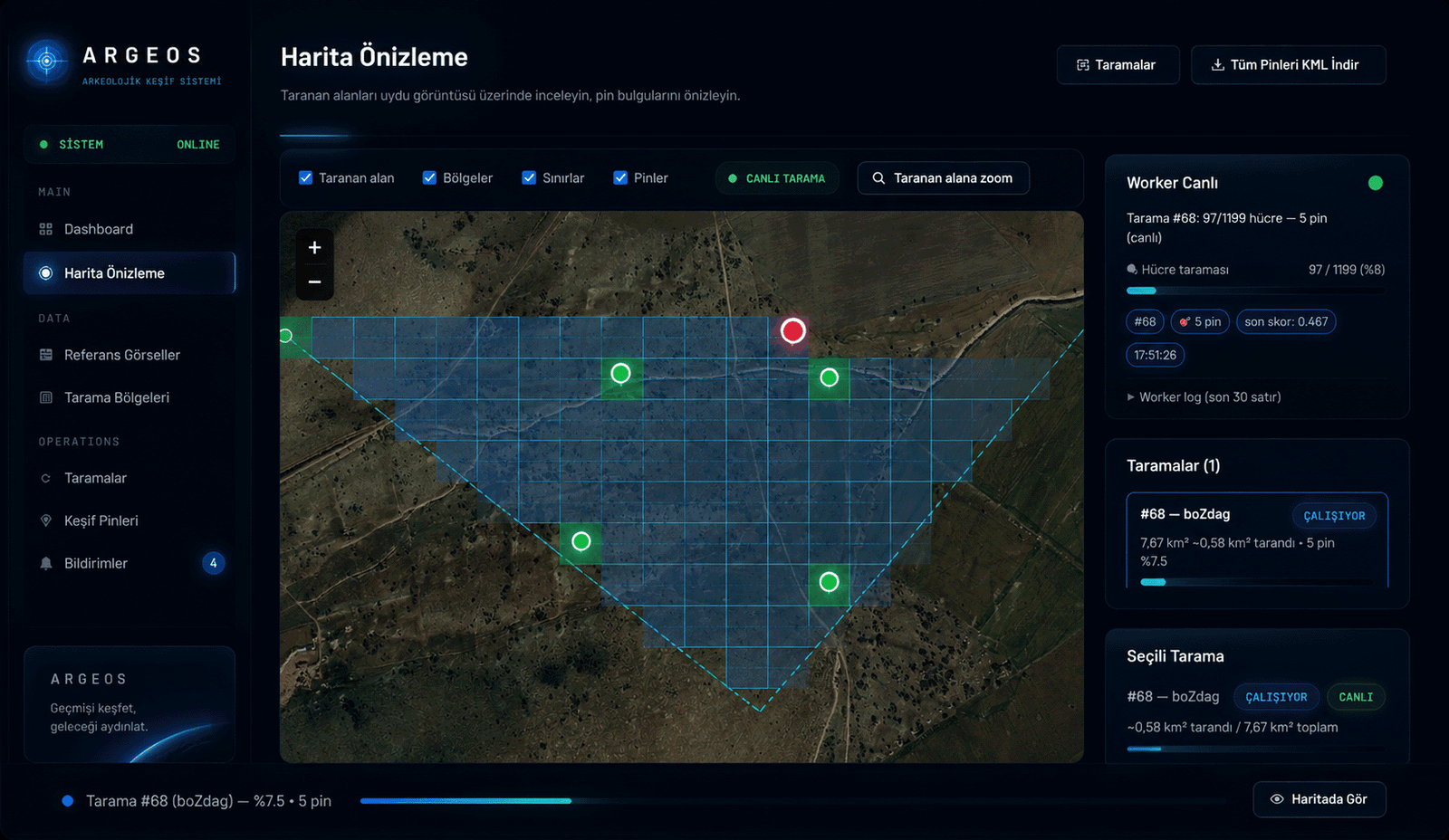
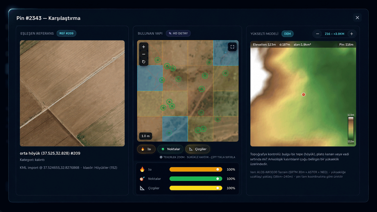
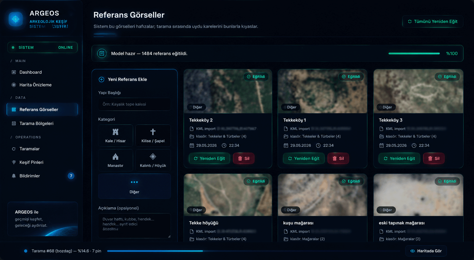
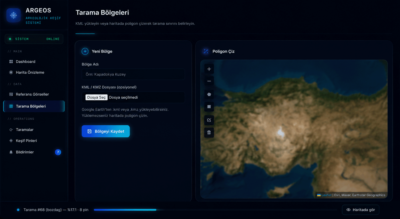
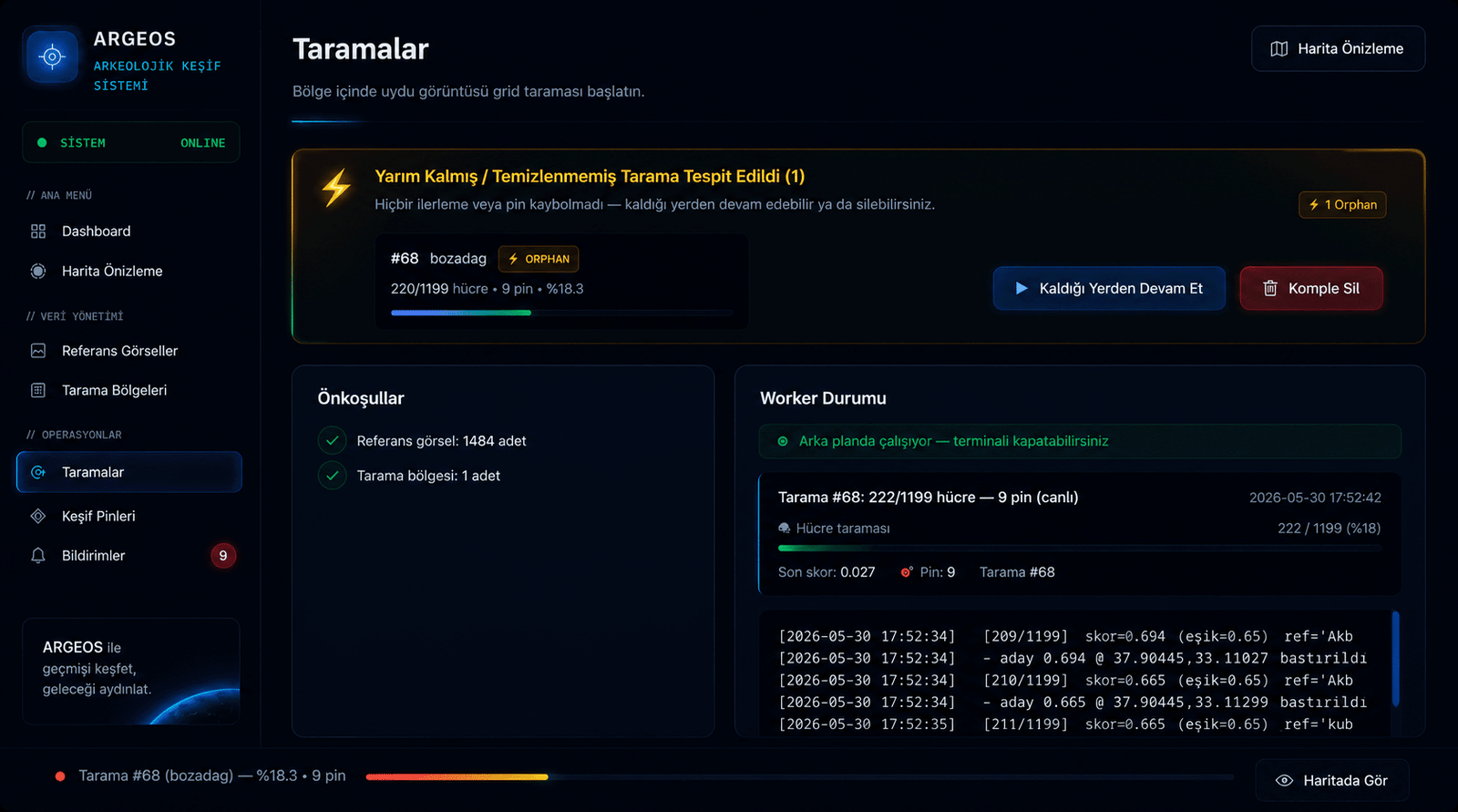
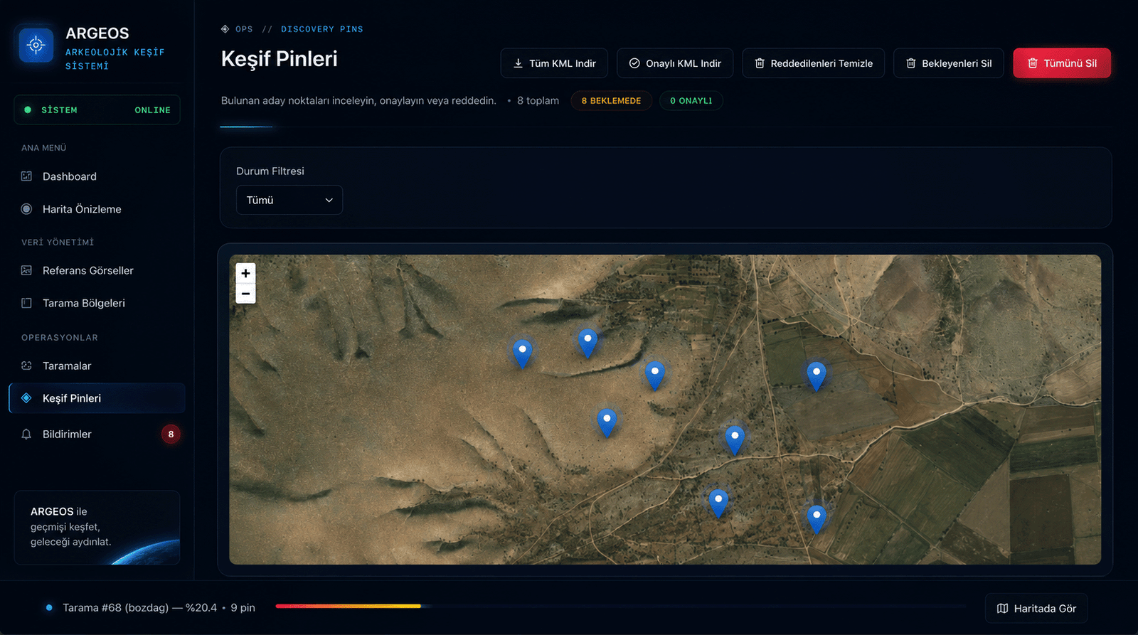
ARGEOS is a deep-learning powered discovery platform that detects undiscovered ancient settlements, mounds, and ruins by matching satellite imagery against a library of reference archaeological structures.
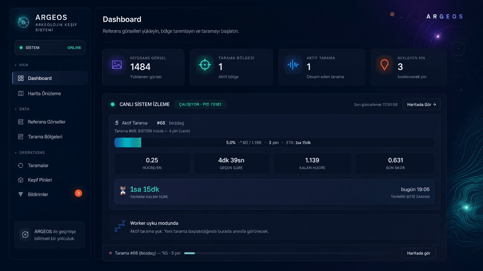
ARGEOS is a command console that compresses field reconnaissance from days into hours. The capabilities below are running in production right now.
Monitor active scans, cells per second, ETA and last score on a single screen. The worker process self-heals on interruption.
Upload KML/KMZ from Google Earth or draw a polygon on the map — the scan never crosses these limits.
Build a reference set from known mounds, castles, monasteries and ruins. The system learns these motifs and uses them in search.
The region is divided into precise grid cells. Every cell is analyzed individually against high-resolution satellite imagery.
Even after a power cut, cancellation, or system error, scans resume where they left off — no detected pins are ever lost.
For each candidate: matched reference · high-res satellite detail · real SRTM/ASTER elevation model (DEM). Topographic check in one click.
Receive an instant alert when a high-confidence candidate is detected. Every finding is logged with its pin number and score.
Download candidate pins as KML compatible with Google Earth/QGIS. Your field team gets the coordinates directly.
In a 7.67 km² test area within the Konya–Karaman corridor, 1,199 grid cells were scanned. In approximately 5 hours, more than 10 high-confidence candidate structures were identified — the majority being mound candidates absent from the known literature.
Real-time system status, active scans and live metrics.
Grid scan over high-resolution satellite imagery.
Trained structure catalogs — categorized classification.
KML upload or polygon drawing on the map.
Progress is preserved through any interruption; continue or delete in one click.
Reference · satellite detail · DEM elevation model, side-by-side.
Instant alert for every high-score finding.
Approval/rejection workflow, filtering and KML export.
The lifecycle is summarized in four steps; behind the scenes, vision-language models, classical computer vision and geospatial analysis work in concert.
Multi-channel feature vectors are extracted from images of known archaeological structures (color, texture, edge, semantic embedding).
The area of interest is defined via KML or polygon; the system slices it into millions of meter-scale cells.
Each cell's high-resolution satellite image is fetched, compared with references, and a confidence score is produced.
Cells above threshold are pinned; experts validate with satellite imagery, DEM elevation model and matched reference.
ARGEOS is currently in early investment stage. See our strategic partnership page for details.
ARGEOS combines techniques from the open literature into a single production pipeline. Which models we use is proprietary; how we combine them is scientific.
Histogram, texture (LBP), shape (HOG), keypoint descriptors and modern deep-learning visual embeddings work together.
A dynamic tile cache operating in Web Mercator projection serves high-resolution imagery on a per-cell basis.
Open elevation data (Terrarium/SRTM/ASTER) is visualized around the pin with hillshade and a color map.
Non-Maximum Suppression removes duplicate detections from adjacent cells; only the best candidate reaches the expert.
We evaluate collaboration requests from universities, museums, excavation teams and national institutions. Apply for early access.
Application Form